AI-powered network
design at scale
Tell Jax what you need — fiber to 10,000 homes, a water distribution network, an electric grid expansion. The AI generates optimized designs using spatial intelligence, terrain analysis, and infrastructure constraints.
10x
Faster design cycles
30%
Lower material costs
99.2%
Design accuracy
Intelligent spatial
design engine
From site survey to frozen design — every step powered by AI spatial reasoning.
Natural Language Design
Describe your network in plain language. Jax translates intent into optimized spatial designs using terrain, demographics, and infrastructure data.
Route Optimization
AI optimizes cable routing, splice placement, and equipment selection using graph algorithms and spatial constraints.
Automatic Bill of Quantities
Every design change instantly updates the BoQ — materials, labor estimates, and cost projections stay in sync.
Constraint Validation
Real-time validation against engineering standards, regulatory requirements, and physical constraints.
Multi-User Design
Multiple engineers work on the same design simultaneously. Changes merge automatically with conflict detection.
Design Versioning
Every design iteration is preserved. Compare versions, branch designs, and roll back to any previous state.
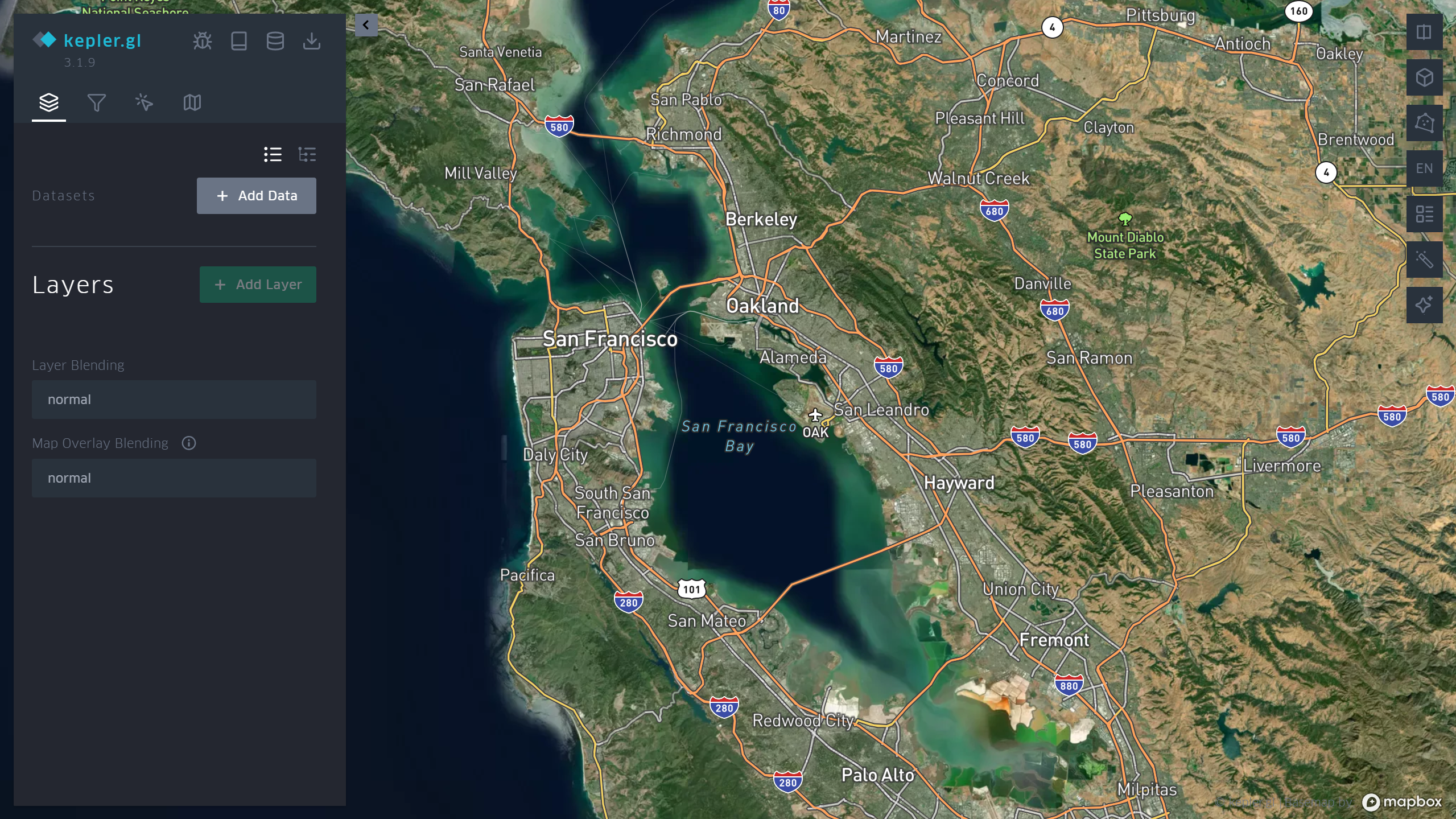
Agentic GIS
Design entire networks through conversation
Talk to the map like a colleague. Navigate anywhere, toggle layers, ask questions about your network, visualize data in 3D, and control every aspect of the GIS — all through natural language.

Mixed-Integer Programming
Mathematically optimal.
Not approximately close.
Nexma solves network design as a mixed-integer program — a branch of combinatorial optimization that guarantees the lowest-cost topology satisfying every engineering constraint. No heuristics. No shortcuts.
Proof of Optimality
ε = 0
Optimality Gap
Proven global optimum, not a local minimum
15–30%
Cost Reduction
vs. rule-based and heuristic solvers
100%
Constraint Satisfaction
Every engineering rule guaranteed
Spatial Intelligence
Ask questions. Get answers from
millions of data points.
Point Nexma at any geospatial dataset and ask in natural language — cluster detection, spatial regression, coverage gaps, routing analysis. 40+ agentic tools execute automatically, visualizing results in real-time on an interactive WebGL map. All processing runs in-browser. Your data never leaves.
Ontology
Your business as code.
Every cable, closure, and cabinet in your network becomes a queryable, auditable object—readable by both your engineers and AI agents. Design decisions don’t get lost in spreadsheets.
Entity Graph
OLT → Cabinet → Closure → Home. Every relationship is typed and constrained.
1,204 addresses · 48 closures · 12 cabinets · One ontology. · Every fiber accounted for.
Fig 4.A — Nexma AI Engine
[FIG 4.A.1] Formalize design intent
Natural language design requirements — coverage targets, equipment constraints, budget limits — are parsed into a formal optimization specification: decision variables, constraints, and objective functions that mathematical solvers can process.
[FIG 4.A.2] Encode spatial context
The physical environment — street geometry, building footprints, existing infrastructure, terrain — is structured into a machine-readable spatial representation that the AI reads and reasons over through deterministic queries.
[FIG 4.A.3] Classify problem structure
The formalized specification is mapped to canonical optimization classes — facility location, network flow, vehicle routing, scheduling — ensuring the right solver family handles each subproblem.
0%
[FIG 4.A.4] Generate optimal design
The selected solver produces a mathematically optimal solution — equipment placement, cable routing, resource allocation — as structured, auditable operations on the spatial representation.
[FIG 4.A.5] Verify against constraints
Every generated design element is validated against engineering standards: capacity thresholds, maximum distances, physical laws, regulatory limits, and budget constraints. Violations are detected and repaired automatically.
[FIG 4.A.6] Converge on minimum cost
A mixed-integer programming solver evaluates the design against alternative configurations, converging on the solution that minimizes total deployment cost while satisfying every validated constraint.
[FIG 4.A.1] Formalize design intent
Natural language design requirements — coverage targets, equipment constraints, budget limits — are parsed into a formal optimization specification: decision variables, constraints, and objective functions that mathematical solvers can process.
[FIG 4.A.2] Encode spatial context
The physical environment — street geometry, building footprints, existing infrastructure, terrain — is structured into a machine-readable spatial representation that the AI reads and reasons over through deterministic queries.
[FIG 4.A.3] Classify problem structure
The formalized specification is mapped to canonical optimization classes — facility location, network flow, vehicle routing, scheduling — ensuring the right solver family handles each subproblem.
[FIG 4.A.4] Generate optimal design
The selected solver produces a mathematically optimal solution — equipment placement, cable routing, resource allocation — as structured, auditable operations on the spatial representation.
[FIG 4.A.5] Verify against constraints
Every generated design element is validated against engineering standards: capacity thresholds, maximum distances, physical laws, regulatory limits, and budget constraints. Violations are detected and repaired automatically.
[FIG 4.A.6] Converge on minimum cost
A mixed-integer programming solver evaluates the design against alternative configurations, converging on the solution that minimizes total deployment cost while satisfying every validated constraint.
Nexma outperforms every competitor.
Every time.The only AI-native FTTH platform on the market
| Capability | IQGeo | 3-GIS | Vetro | Biarri | Bentley | Nexma |
|---|---|---|---|---|---|---|
| AI-Powered Design | — | — | — | — | — | ✓ |
| Natural Language Interface | — | — | — | — | — | ✓ |
| Automated Splice Planning | ½ | — | — | — | — | ✓ |
| Network Optimization | ✓ | ½ | — | ✓ | — | ✓ |
| Computer Vision QC | ✓ | ½ | — | — | — | ✓ |
| Voice Interface | — | — | — | — | — | ✓ |
| Cloud-Native SaaS | ½ | ½ | ✓ | ✓ | — | ✓ |
| Full Lifecycle | ½ | ½ | ½ | — | — | ✓ |
| Large-Scale Spatial Analytics | ½ | — | — | — | ½ | ✓ |
Competitors bolt on features through acquisitions. Nexma was built AI-native from day one — design, splicing, field QC, and voice in a single platform.
We outperform frontier models in head-to-head testing
Design accuracy based on field validation data from production FTTH deployments across 12 countries.
Advancing the frontier of spatial AI.
Our research team publishes openly on the methods behind Nexma's spatial intelligence. From spatial reasoning architectures to multi-domain schema systems, we share the technical foundations that make autonomous infrastructure design possible.
Persistent Memory Architecture for Autonomous Infrastructure Agents
A codex-based memory system that enables AI agents to accumulate and retrieve deployment knowledge across projects. Agents with persistent memory produce 18% fewer field corrections than stateless baselines.
Spatial Reasoning in Large Language Models for Infrastructure Planning
We introduce a structured spatial encoding that enables LLMs to reason about physical infrastructure — distances, topology, and routing constraints — with engineering-grade precision. Our approach bridges the gap between natural language understanding and geospatial computation.
From intent to
frozen design
Define Scope
Upload your service area or describe it in natural language. Jax analyzes terrain, demographics, and existing infrastructure.
Generate Design
AI generates multiple design alternatives optimized for cost, performance, and constructability.
Refine & Validate
Engineers review, adjust, and validate. Every change triggers real-time constraint checking.
Freeze Baseline
Approve the design and freeze it as an immutable baseline. Construction documents generate automatically.
Ready to design
at the speed of AI?
See how Nexma Design transforms weeks of manual engineering into hours of AI-assisted spatial design.